Topography and Photogrammetry
Topographical Surveys
We collect data from the plot under study and generate precise and detailed plans of the plot according to the client’s requirements
Photogrammetry
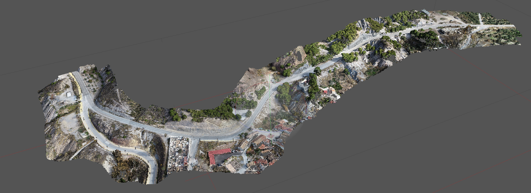
We generate 3D models from the images provided by drones (and other sources). We use the latest technologies, with professional and stabilised optical equipment. This allows us to generate reconstructions of the highest quality and accuracy. To these, we add the taking of control points to obtain a high resolution and absolute centimetric georeferenced model.

The example image shows a dense point cloud obtained from 116 high-resolution images and 14 ground control points obtained with a dual-frequency GNSS receiver with coordinates corrected by menas of the Andalusian Positioning Network. The resulting model is used for a linear civil engineering project.
